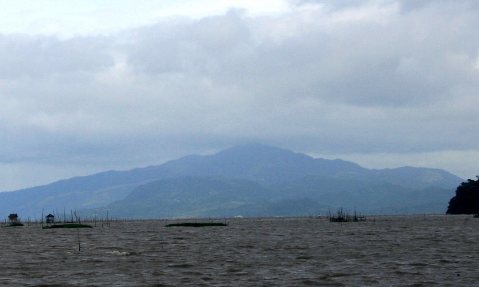
Mt. Sembrano is situated about 60 kilometers (37 mi) east by road from the capital city of Manila.
Geography
Mount Sembrano lies between the boundaries of the towns of Jalajala and Pililla in Rizal province and the town of Pakil in Laguna. The mountain sits at the helm of Jalajala peninsula along the shore of Laguna de Bay and is surrounded by the lake on three sides. Along with Talim Island, the mountain forms the southeastern rim of the Laguna Caldera.
Hiking
Once a haven of New People's Army insurgents, the mountain is now a popular hiking destination offering a commanding view of Laguna de Bay, Talim Island, and the Tagalog provinces of Rizal and Laguna. Mount Susong Dalaga (Maiden's breast Mountain), a conical hill resembling the female breast which is the highest peak of the neighboring Talim Island, is best observed from Mt. Sembrano. Other mountains visible from the summit are Mount Banahaw, Mount Makiling and the Sierra Madre Mountains.
Starting point
The most common starting point for the climb up the mountain is from the Barangay Hall in Brgy. Malaya in Pililla, Rizal where climbers must register themselves. The hike to the grassy summit which is fully exposed to the sun, takes about three to four hours. Another trail starts from the Laguna side of the mountain in the town of Pakil, but is rarely used.
Our Lady of Maulawin
Mount Sembrano is considered sacred by some people and known for the legend of the miraculous discovery of the icon of Our Lady of Maulawin. One farmer was gathering firewood in the forest on the Jalajala side of the mountain when he heard the voice of a woman while cutting a tree. Inside, he found a simulacrum of Mother Mary imprinted on the trunk. The icon is now enshrined in the Catholic church of Santa Cruz in Laguna. A small chapel is placed on the site where the image was discovered.
Other points of interest
Another point along the trail is a big boulder referred to as the Simbahan (Church) where pilgrims leave candles on the huge rock where footprints imprinted on top are supposedly left by the Virgin Mary.
Five minutes off the trail is the small Manggahan waterfall, located left of the campsite if you are on your way up. The falls provide water for overnight campers and day trekkers.
Accommodations
- Loreland Farm Resort
Location: Sitio Loreland, Barangay San Roque, Antipolo City, Antipolo / Rizal, Manila, Philippines
- Seven Suites Hotel Observatory
Location: Hollywood Hills Sumulong Highway, Antipolo / Rizal, Manila, Philippines
- Thunderbird Resorts - Rizal
Location: Eastridge Avenue, Binangonan, Antipolo / Rizal, Manila, Philippines
- Villa Jhoana Resort
Location: Ibanez St., Angono, Rizal, Antipolo / Rizal, Manila, Philippines
How to get there
- The province of Rizal is 110 kilometers south of Manila. It is accessible by land transportation from Metro Manila and the neighboring provinces of Southern Tagalog and Central Luzon.
- Buses, varied public utility vehicles, and the metro rail system with stations at Crossing/EDSA in Mandaluyong City, Robinson’s Galleria in Ortigas Avenue, Quezon City and Farmer’s Market in Cubao, Quezon City ply the routes to Antipolo, Taytay, Cainta, Binangonan, Angono, Tanay and other towns in Rizal.
- In touring around the town or from one city to another city, jeepneys and tricycles are available as a mode of transportation.


